


Catch the Sediment
Why is it necessary?
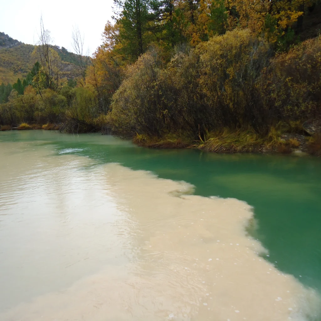
Water erosion is a natural process that can be degraded by human activities such as mining and construction. These activities can significantly increase sediment content in rivers, leading to substantial environmental and economic negative impacts.
A 2022 study published in Nature quantified that less than 6% of global sediment transport is due to natural processes. Additionally, between 1950 and 2010, human activity increased river sediment by 215%, with sediment production on slopes increasing by 467% due to activities like mining and construction.

Patented Monitoring System to Prevent River Pollution by Sediments
Why is it necessary?
Water erosion is a natural process that can be degraded by human activities such as mining and construction. These activities can significantly increase sediment content in rivers, leading to substantial environmental and economic negative impacts.
A 2022 study published in Nature quantified that less than 6% of global sediment transport is due to natural processes. Additionally, between 1950 and 2010, human activity increased river sediment by 215%, with sediment production on slopes increasing by 467% due to activities like mining and construction.
Patented Monitoring System to Prevent River Pollution by Sediments
Why is it necessary?
Water erosion is a natural process that can be degraded by human activities such as mining and construction. These activities can significantly increase sediment content in rivers, leading to substantial environmental and economic negative impacts.
A 2022 study published in Nature quantified that less than 6% of global sediment transport is due to natural processes. Additionally, between 1950 and 2010, human activity increased river sediment by 215%, with sediment production on slopes increasing by 467% due to activities like mining and construction.

7
Number of Hydrological Stations
Our Solution
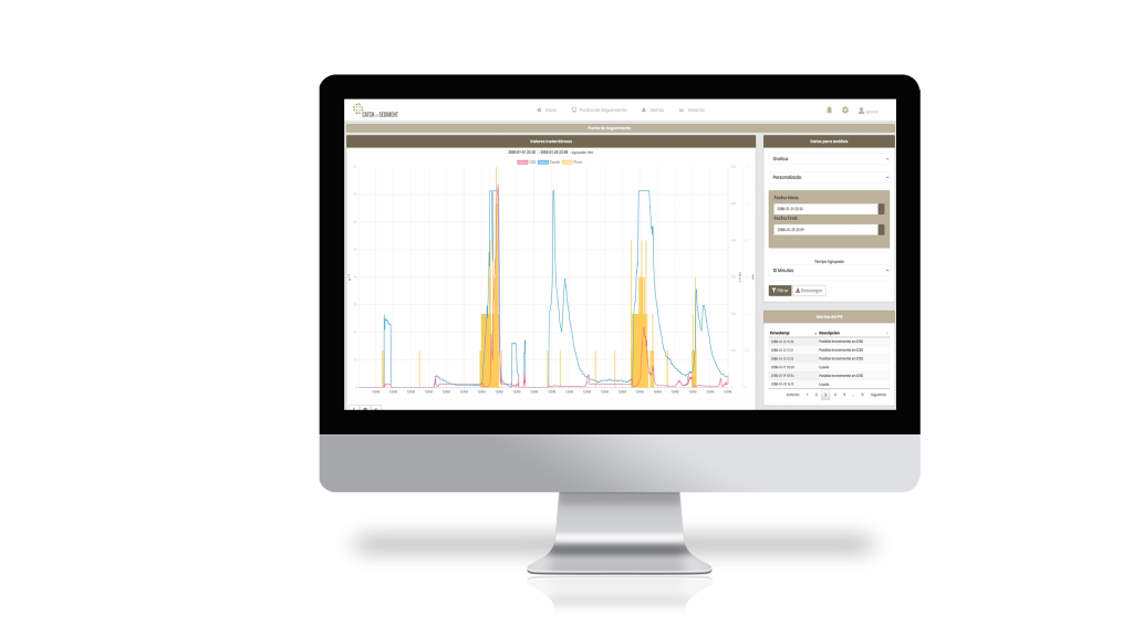
Catch The Sediment is a cloud-based service that detects real-time episodes of sediment pollution. Our patented system provides accurate and instantaneous information, enabling effective corrective actions, minimizing the risk of penalties, and strengthening companies’ commitment to environmental sustainability. It is based on three main features:
Determination of a Dynamic and Real River Baseline:
Our system recognizes that sediment and discharge values in any natural river course are not static. Therefore, the values used to assess contamination must also vary.
Installation of a Monitoring Device:
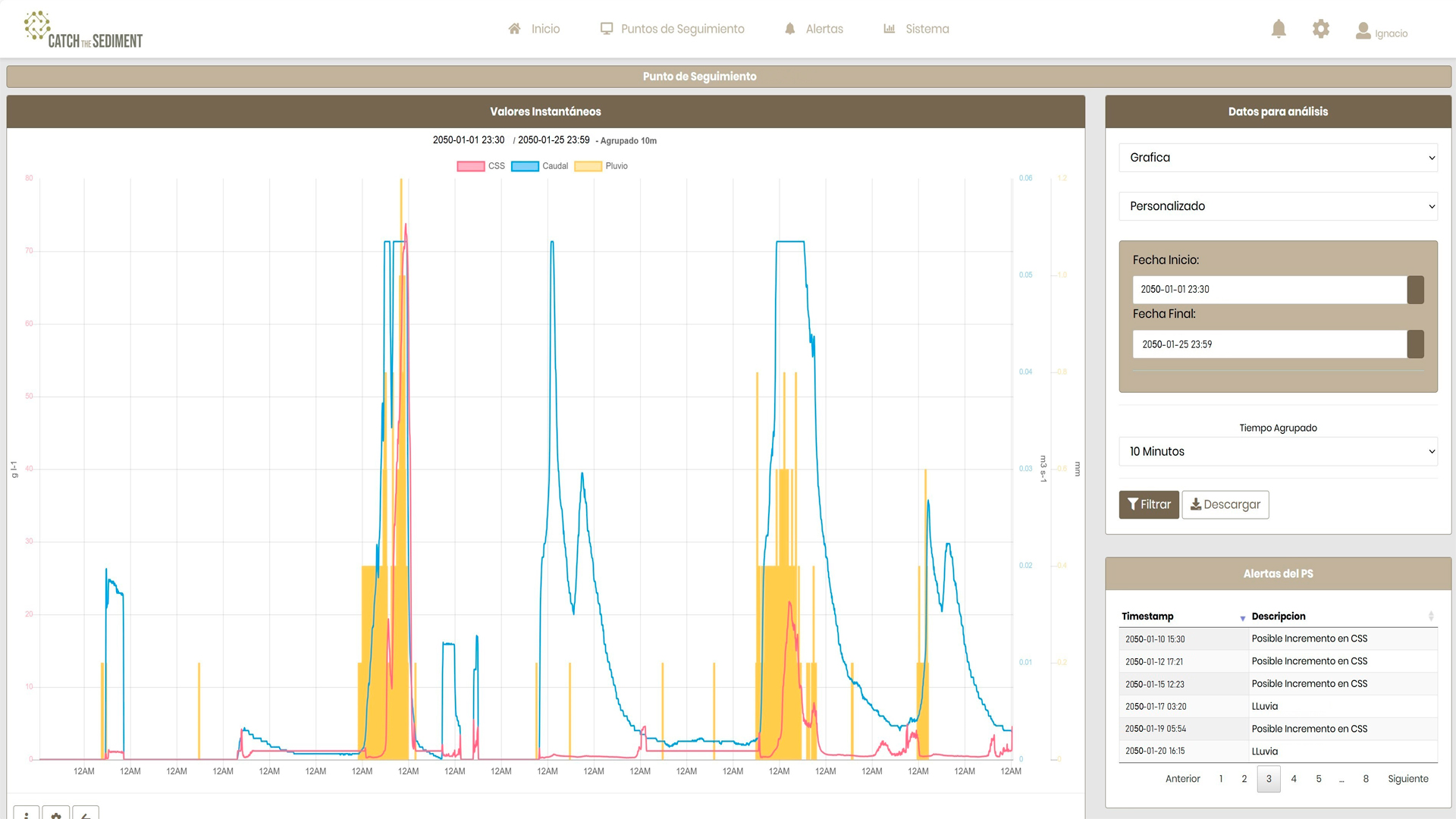
This device reads sediment concentration and discharge data from the hydrological station located at the potential pollution point. These data are processed in real-time by our patented service.
Digital Platform for Real-Time Information and Alerts:
Our platform allows visualization of sediment and discharge levels and generates real-time alerts when sediment levels exceed desired thresholds.
4
Number of Active Projects
7
Number of Hydrological Stations
4
Number of Active Projects
Our Solution
Catch The Sediment is a cloud-based service that detects real-time episodes of sediment pollution. Our patented system provides accurate and instantaneous information, enabling effective corrective actions, minimizing the risk of penalties, and strengthening companies’ commitment to environmental sustainability. It is based on three main features:
Determination of a Dynamic and Real River Baseline:
Our system recognizes that sediment and discharge values in any natural river course are not static. Therefore, the values used to assess contamination must also vary.
Installation of a Monitoring Device:
This device reads sediment concentration and discharge data from the hydrological station located at the potential pollution point. These data are processed in real-time by our patented service.
Digital Platform for Real-Time Information and Alerts:
Our platform allows visualization of sediment and discharge levels and generates real-time alerts when sediment levels exceed desired thresholds.
7
Number of Hydrological Stations
Our Solution
Catch The Sediment is a cloud-based service that detects real-time episodes of sediment pollution. Our patented system provides accurate and instantaneous information, enabling effective corrective actions, minimizing the risk of penalties, and strengthening companies’ commitment to environmental sustainability. It is based on three main features:
Determination of a Dynamic and Real River Baseline:
Our system recognizes that sediment and discharge values in any natural river course are not static. Therefore, the values used to assess contamination must also vary.
Installation of a Monitoring Device:
This device reads sediment concentration and discharge data from the hydrological station located at the potential pollution point. These data are processed in real-time by our patented service.
Digital Platform for Real-Time Information and Alerts:
Our platform allows visualization of sediment and discharge levels and generates real-time alerts when sediment levels exceed desired thresholds.
4
Number of Active Projects
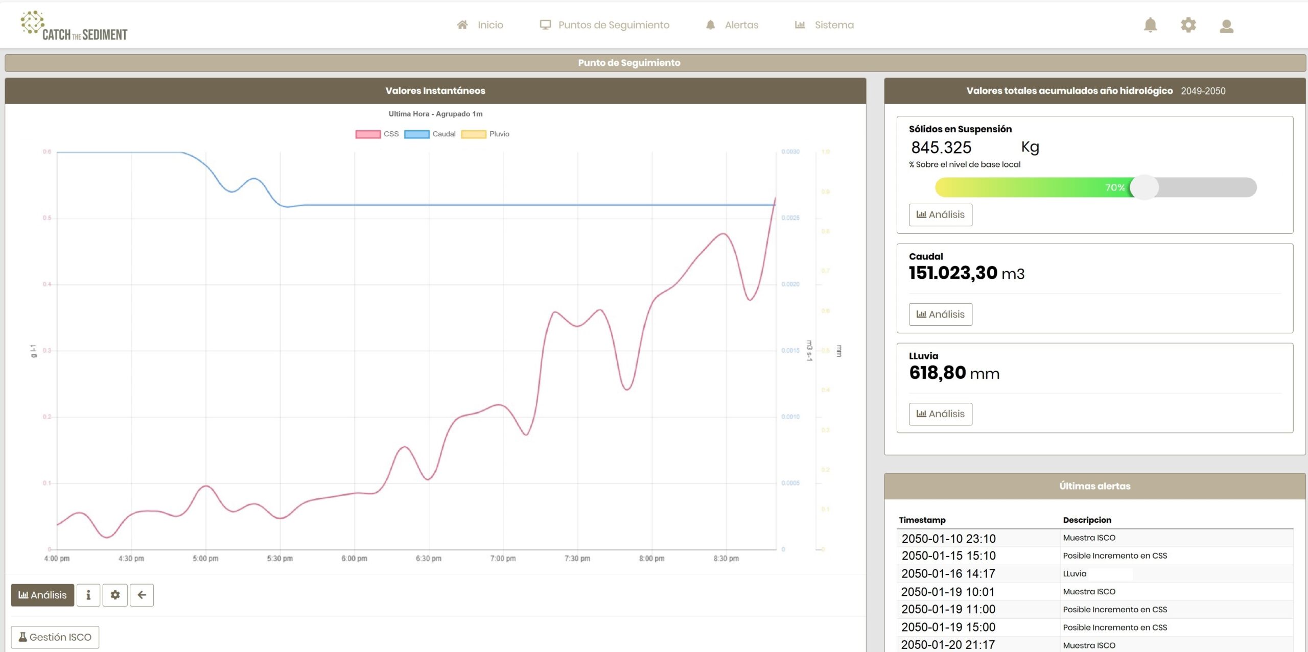
Unique Features of Catch the Sediment
- Considers the natural variability of discharge and sediment in the river receiving the spill.
- Based on real sediment values and discharge volume, not estimates or indirect/modeled values.
- Detects all pollution episodes without generating false positives.
- Improves the environmental health of rivers and provides crucial protection against legal and financial repercussions associated with water pollution.

Unique Features of Catch the Sediment
- Considers the natural variability of discharge and sediment in the river receiving the spill.
- Based on real sediment values and discharge volume, not estimates or indirect/modeled values.
- Detects all pollution episodes without generating false positives.
- Improves the environmental health of rivers and provides crucial protection against legal and financial repercussions associated with water pollution.
Unique Features of Catch the Sediment
- Considers the natural variability of discharge and sediment in the river receiving the spill.
- Based on real sediment values and discharge volume, not estimates or indirect/modeled values.
- Detects all pollution episodes without generating false positives.
- Improves the environmental health of rivers and provides crucial protection against legal and financial repercussions associated with water pollution.